UNDERGROUND UTILITY SURVEYS

UNLOCK THE SECRETS BENEATH THE SURFACE AND
DEVELOP WITH COORDINATED CONFIDENCE

Mitigating Risk & Ensuring Project Safety

Uncovering the unseen is essential to any construction project. Our Underground Utility Surveying provides an extensive picture of the underground environment, including the location and identification of gas, water, electricity, and telecommunications lines. This ensures the safety of your project, saves time, and reduces the risk of costly disruptions.

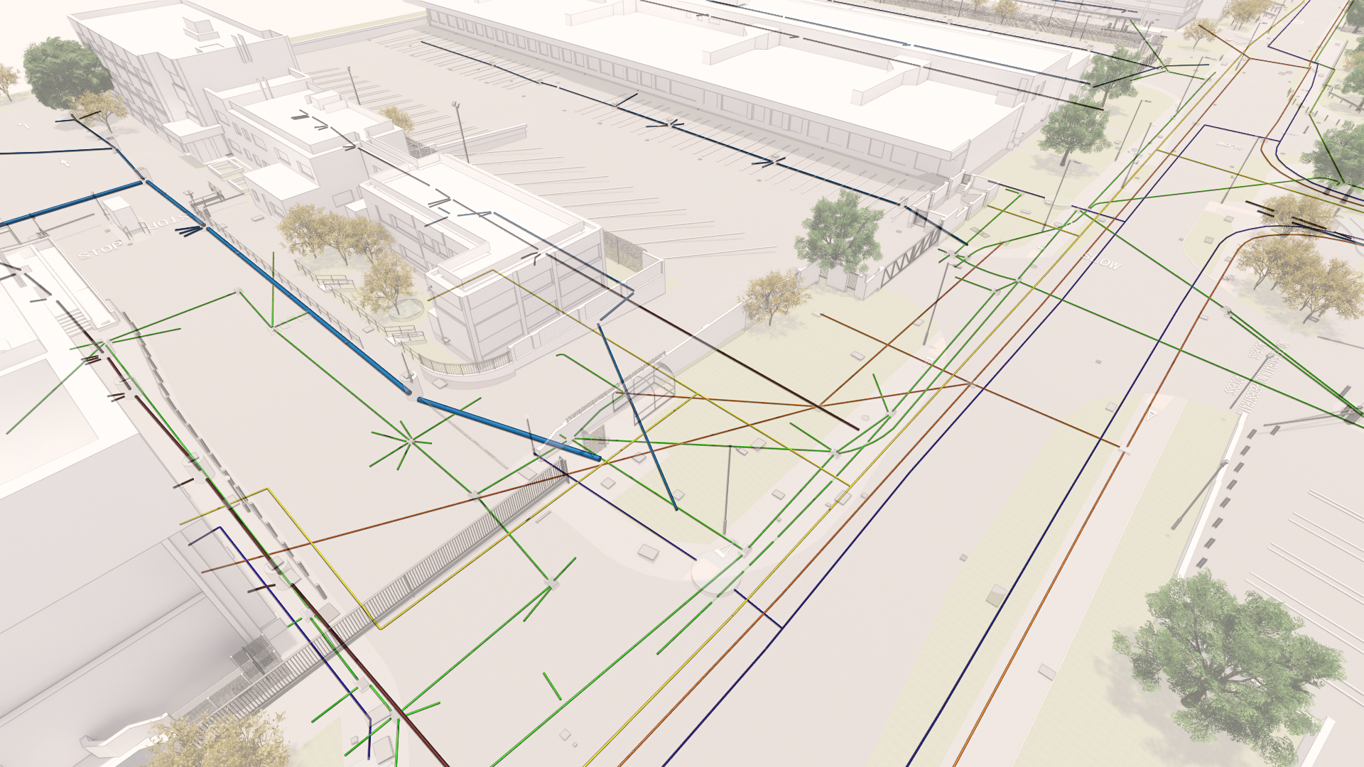
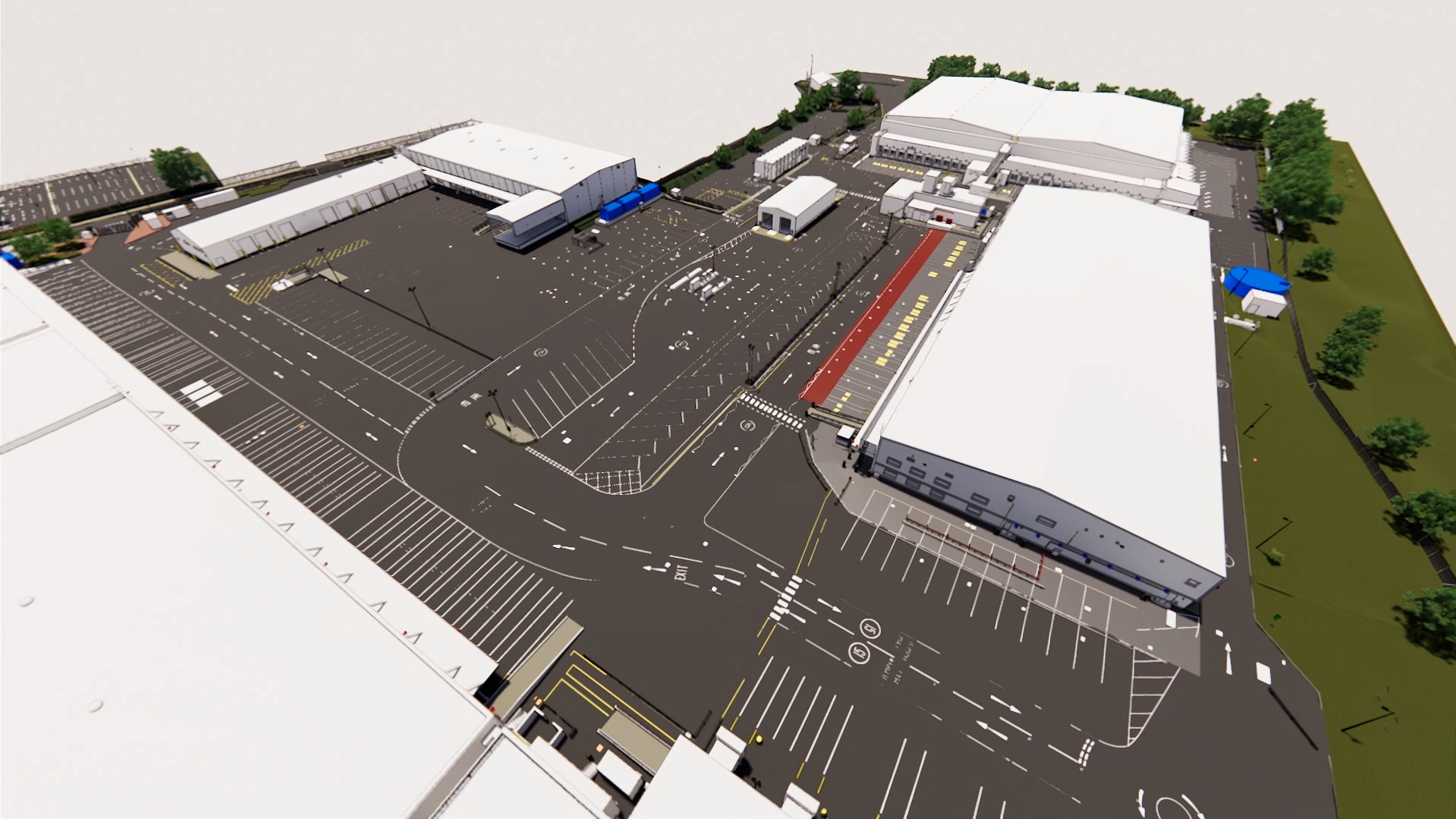
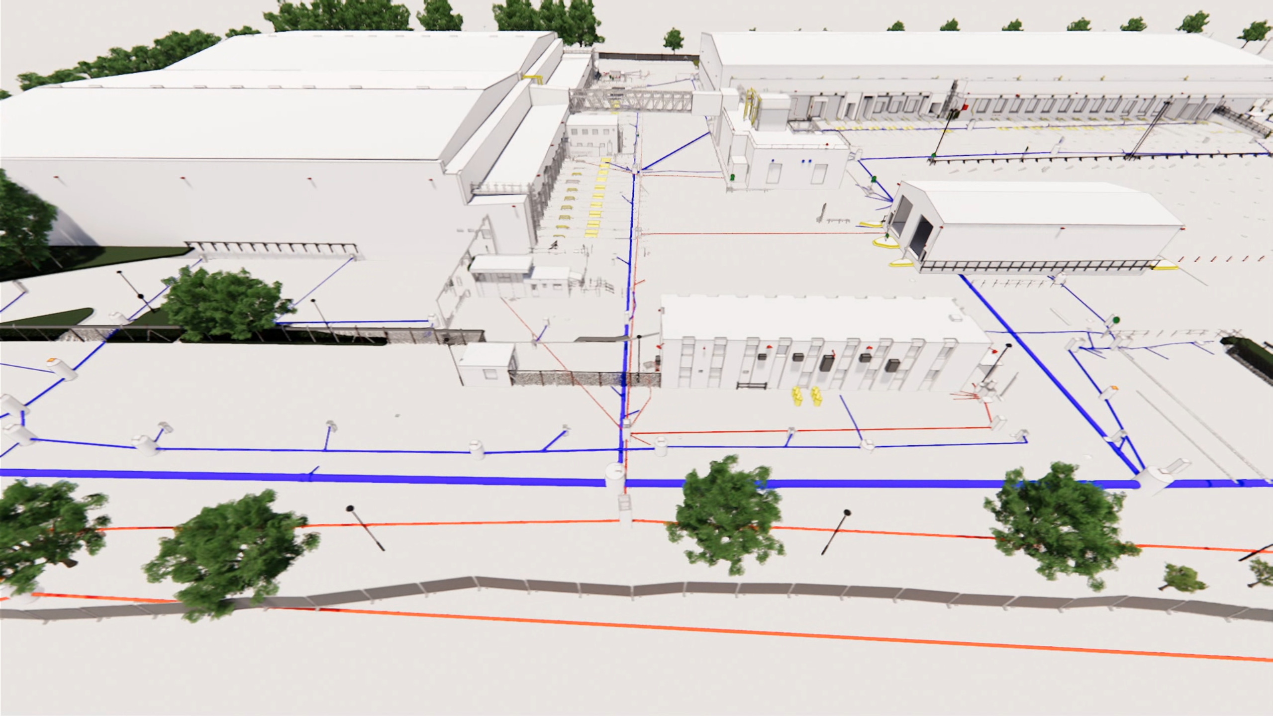
3D/BIM Reports: Unprecedented Accuracy & Comprehension

Digital Inc goes beyond standard 2D reports to provide you with results in a highly visual and interactive 3D / BIM format. Imagine being able to see the full picture of your project, with underground utilities, services and structures displayed in an easy-to-understand and accessible 3D environment. This provides you with an unprecedented level of accuracy, detail and comprehension, allowing you to make confident and informed decisions every step of the way.

BENEFITS OF UNDERGROUND SURVEYS

  • Damage prevention:
    Minimise risk during excavation or construction.

  • Cost savings:
    Reduce expenses from utility strikes and delays.

  • Safety enhancement:
    Protect workers and public from hazards.

  • Comprehensive planning:
    Inform design and maintenance decisions.

  • Asset management:
    Optimise lifecycle management and future upgrades.

  • Regulatory compliance:
    Adhere to legal requirements and industry standards.

HOW DOES IT WORK?

MEASUREMENT, MODELLING AND ANALYSIS

  • Delivering expertise and scale

  • Optimised technology and processes

  • Rapid programmes

  • With a personal service

FAQs

Underground utility surveys use non-destructive techniques, such as ground-penetrating radar (GPR), electromagnetic locators, and radio detection, to identify and map subsurface utilities. Surveyors collect data on-site and process it using specialised software to create accurate 2D or 3D maps, plans, and digital models of the underground infrastructure.

The accuracy of underground utility surveys depends on factors such as equipment used, site conditions, and the experience of the surveyors. When properly conducted, these surveys can achieve high levels of accuracy, locating utilities within a few centimetres. It is important to note that the accuracy may be affected by soil composition, depth, and the presence of other utilities or structures.

The cost of underground utility surveys varies depending on factors such as project size, location, required accuracy, and the equipment used. Prices may also depend on the complexity of the subsurface infrastructure and site conditions.

Get in touch with us to discuss your needs and we will be able to give you an accurate quote.

Underground utility surveys have diverse applications across various industries, including:

Construction and engineering: Avoiding damage to utilities during excavation, drilling, or trenching.

Asset management: Mapping and documenting subsurface utilities for better maintenance and planning.

Urban planning: Informing land development, infrastructure design, and transportation projects.

Environmental management: Identifying potential hazards and ensuring proper mitigation measures.

Legal compliance: Adhering to regulations regarding utility detection and mapping.

Emergency response: Locating damaged utilities during disaster recovery or repair operations.

Environmental management: Analyzing landforms, drainage patterns, and vegetation for conservation efforts.

GET IN TOUCH