PHOTOGRAMMETRY

RECORD AND EXPLORE YOUR SITE WITH STUNNING DETAIL AND PRECISION

Precision & Speed for a Competitive Edge

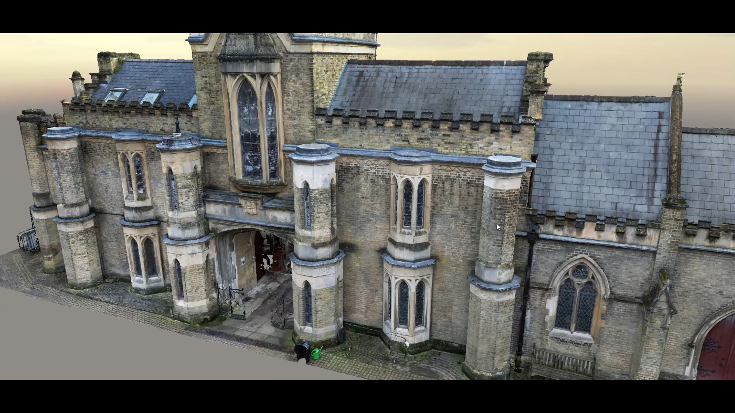
At Digital Inc, we harness the power of photogrammetry to bring your projects to life. Photogrammetry provides a powerful tool for professionals, such as architecture, engineering, archaeology, and geospatial analysis, to understand, explore and analyse their projects, landscapes, and structures. With its ability to produce detailed and precise models in a fraction of the time, photogrammetry is a valuable asset for our clients looking to gain a competitive edge. Our expertise in this field allows us to collect and process aerial images and data to create detailed and accurate 3D models.

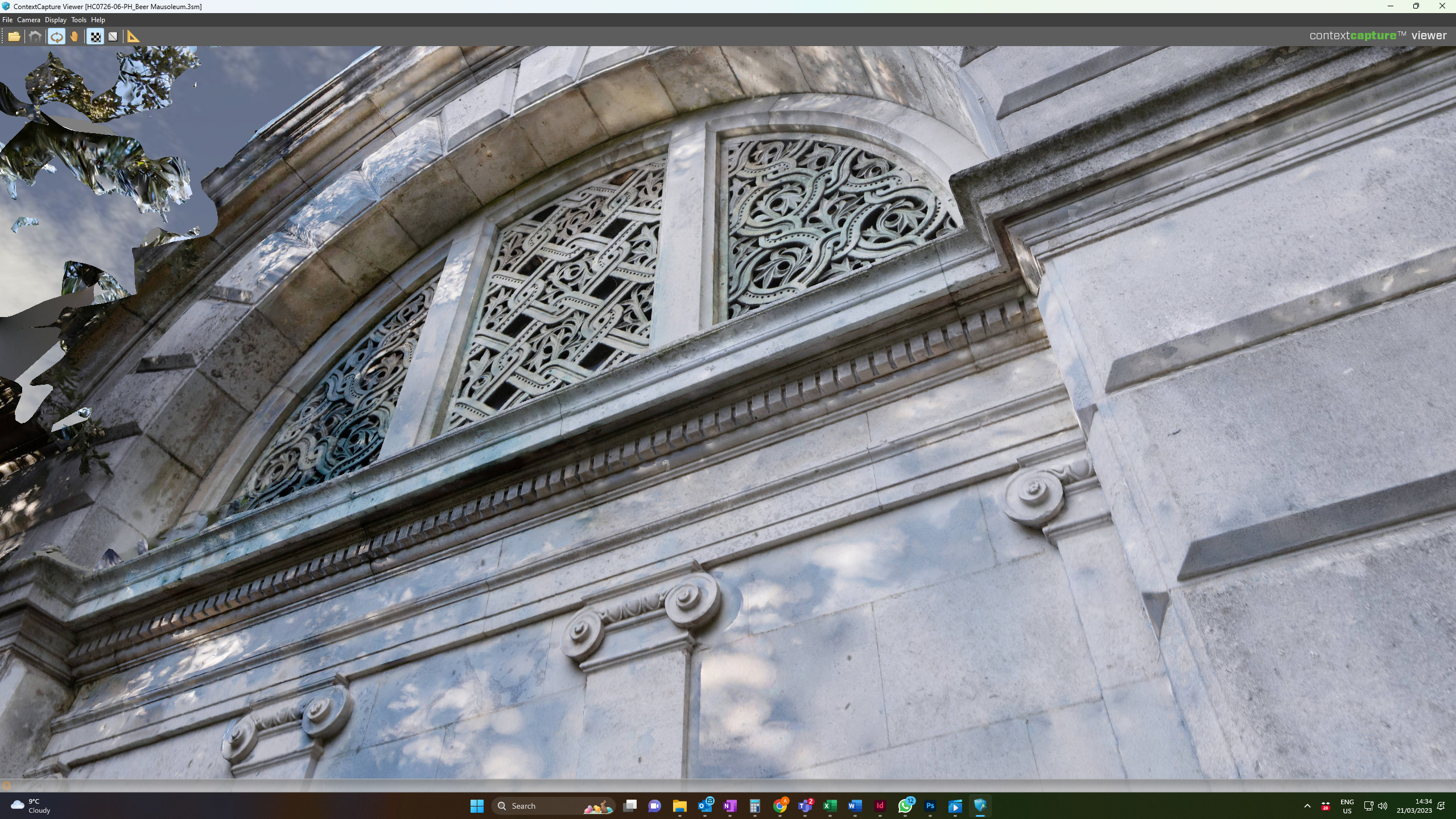
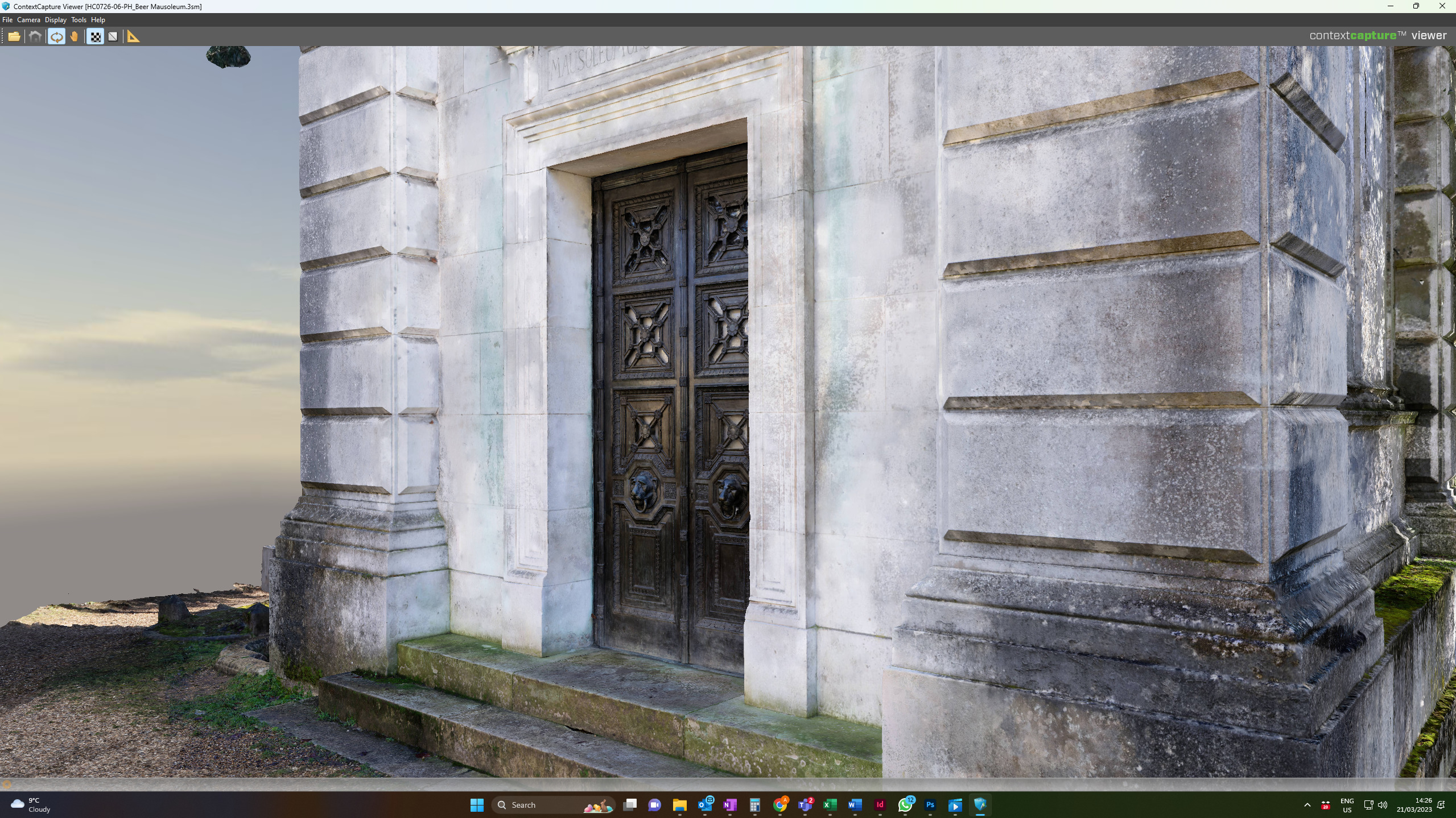
Heritage Preservation: Visually Stunning Accuracy

Photogrammetry can be especially beneficial for heritage recording, enabling the preservation and dissemination of valuable cultural information. Our models are not only visually stunning, but also incredibly accurate, providing essential data and insights that inform and support your development, refurbishment, or restoration plans.

BENEFITS OF PHOTOGRAMMETRY

  • High accuracy:

    Precise measurements from high-resolution images.
  • Time-saving:
    Faster than traditional methods, reducing on-site time.

  • Cost-effective:
    Fewer resources and personnel required.

  • Non-invasive:
    Remote sensing minimizes disturbance and ensures safety.

  • Versatile:
    Applicable to various industries.

  • Digital data:
    Easily stored, shared, and integrated with GIS systems

HOW DOES IT WORK?

MEASUREMENT, MODELLING AND ANALYSIS

  • Delivering expertise and scale

  • Optimised technology and processes

  • Rapid programmes

  • With a personal service

FAQs

Photogrammetry is a technique that uses images to create precise measurements and three-dimensional models of objects, structures, or landscapes. By capturing multiple high-resolution photographs from different angles, photogrammetry software processes these images and identifies common points, called tie points, between them. Through complex mathematical algorithms, the software calculates the spatial position and dimensions of the captured objects, generating a highly accurate digital representation.

The accuracy of photogrammetry depends on several factors, such as the quality of the images, the camera calibration, the positioning of ground control points (GCPs), and the photogrammetry software used. In optimal conditions, photogrammetry can achieve accuracies ranging from sub-centimeter to a few centimeters. High-resolution cameras, careful planning, and the use of accurate GCPs can further enhance the precision of the final output. However, it’s essential to note that external factors like atmospheric conditions, terrain, and vegetation can affect the accuracy to some extent.

Despite these potential limitations, photogrammetry is considered a highly accurate technique for various surveying and mapping applications.

The cost of photogrammetry largely depends on the requirements and size of your project as well asĀ  the level of detail needed for it.

Get in touch with us to discuss your needs and we will be able to give you an accurate quote.

Photogrammetry is a versatile technique with numerous applications across various industries. Some common uses include:

  1. Topographic mapping: Creating accurate maps of terrain and landscapes for urban planning, environmental studies, and geological investigations.
  2. Construction and engineering: Monitoring progress, inspecting structures, and generating as-built models for infrastructure projects like roads, bridges, and buildings.
  3. Archaeology and cultural heritage: Documenting and preserving historical sites, monuments, and artifacts, enabling the creation of 3D models for research and visualization purposes.
  4. Forestry and agriculture: Estimating tree heights, canopy cover, and biomass, as well as monitoring crop health and managing resources.
  5. Mining and geology: Conducting volumetric analysis, monitoring mine progress, and creating geological maps for mineral exploration.
  6. Disaster management: Assessing damage and aiding in recovery efforts following natural disasters such as earthquakes, floods, and landslides.
  7. Urban planning: Analyzing land use patterns, transportation networks, and infrastructure development for better city management.
  8. Film and entertainment: Creating realistic 3D models and environments for video games, movies, and virtual reality experiences.

These are just a few examples of the many applications of photogrammetry, showcasing its widespread utility across diverse fields.

GET IN TOUCH