TRADITIONAL & TOPOGRAPHICAL

BLENDING TRADITIONAL SURVEYS AND CUTTING-EDGE CAPTURING TECHNOLOGY

Detail & Accuracy for Informed Decisions

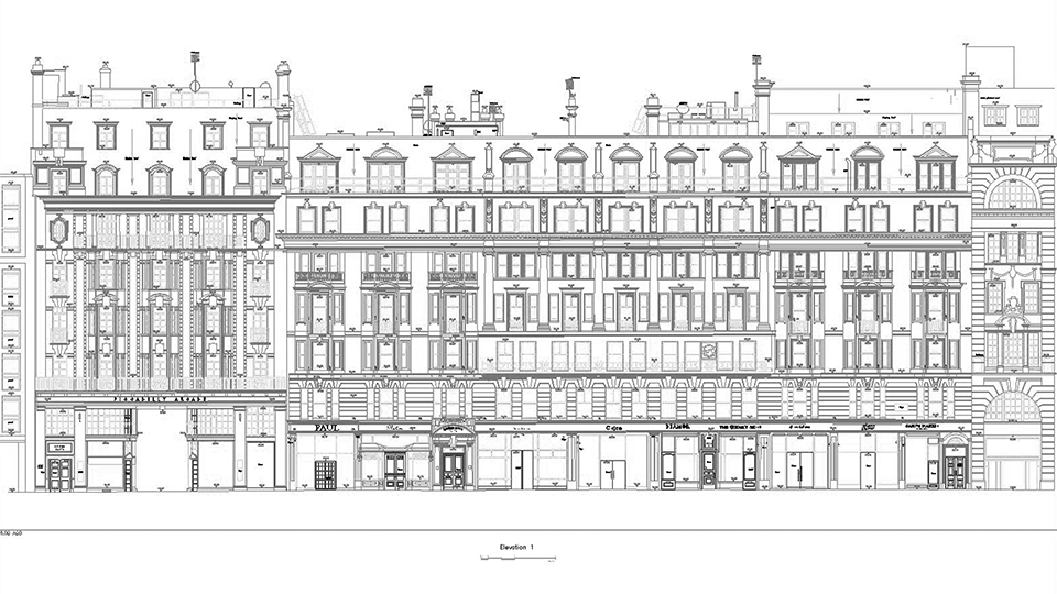
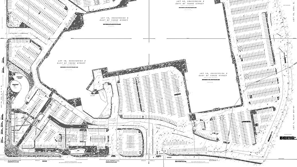
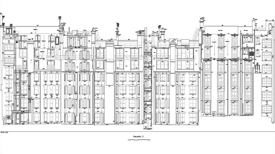
With striking detail and unmatched accuracy, we provide essential data for informed early decisions. Clients are increasingly choosing 3D laser scanning over limited 2D measured surveys for a more comprehensive site capture.

Precision & Flexibility for Future-Proof Plans

Our advanced 3D laser scanning captures projects in exceptional detail, generating a point cloud convertible into accurate 2D plans, sections, and topographies. Scans can be upgraded to 3D or BIM later, providing unparalleled flexibility and versatility.

Informed Decisions, Empowered Stakeholders

Our surveys’ 360° virtual tour helps stakeholders to fully visualise the project and make informed decisions, without needing to be on site. Whether it’s for planning, design, or execution purposes, Digital Inc’s traditional 2D surveys with 3D laser scanning capabilities deliver an empowering solution.

BENEFITS OF TRADITIONAL SURVEYS

  • Spatial accuracy:
    Precise measurements for accurate area representation.

  • Land use planning:
    Informed decisions for development and construction.

  • Resource management:
    Supports environmental conservation efforts.

  • Engineering design:
    Assists in designing roads, buildings, and utilities.

  • Flood risk assessment:
    Identifies low-lying areas for effective management.

  • Legal documentation:
    Essential for land registration and boundary disputes.

HOW DOES IT WORK?

MEASUREMENT, MODELLING AND ANALYSIS

  • Delivering expertise and scale

  • Optimised technology and processes

  • Rapid programmes

  • With a personal service

FAQs

Traditional and topographical surveys involve using instruments like total stations, GNSS (Global Navigation Satellite System) receivers, and levels to measure distances, angles, and elevations of the terrain and existing features. Surveyors collect data points on-site and then process them using specialized software to create accurate 2D or 3D maps, plans, and digital terrain models.

The accuracy of traditional and topographical surveys depends on the equipment used, surveying techniques, and the experience of the surveyors. When properly conducted, these surveys can achieve sub-centimeter to centimeter-level accuracy. High-quality instruments and careful planning help enhance the overall precision of the resulting data.

The cost of traditional and topographical surveys varies depending on factors such as project size, location, required accuracy, and the equipment used. Prices may also depend on the complexity of the terrain and the level of detail required.

Get in touch with us to discuss your needs and we will be able to give you an accurate quote.

Traditional and topographical surveys have diverse applications across various industries, including:

Land development: Planning and designing infrastructure, buildings, and subdivisions.

Engineering projects: Providing accurate data for roads, bridges, and utility installations.

Environmental management: Analyzing landforms, drainage patterns, and vegetation for conservation efforts.

Legal documentation: Establishing property boundaries and resolving disputes. e. Resource management: Assessing natural resources like soil, water, and minerals.

Urban planning: Evaluating land use, transportation networks, and infrastructure development.

GET IN TOUCH