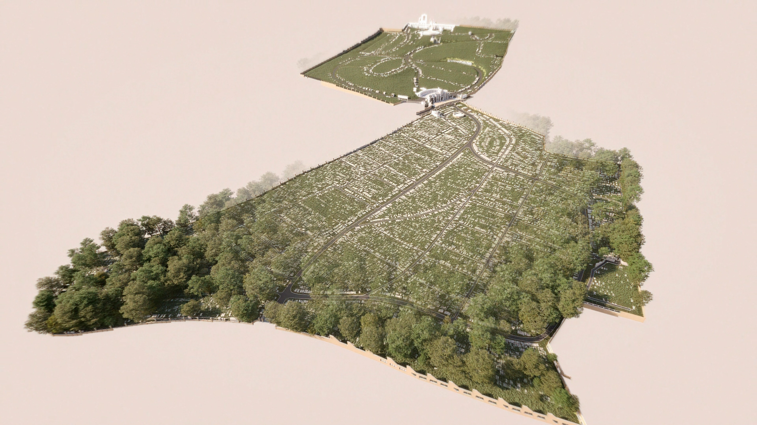
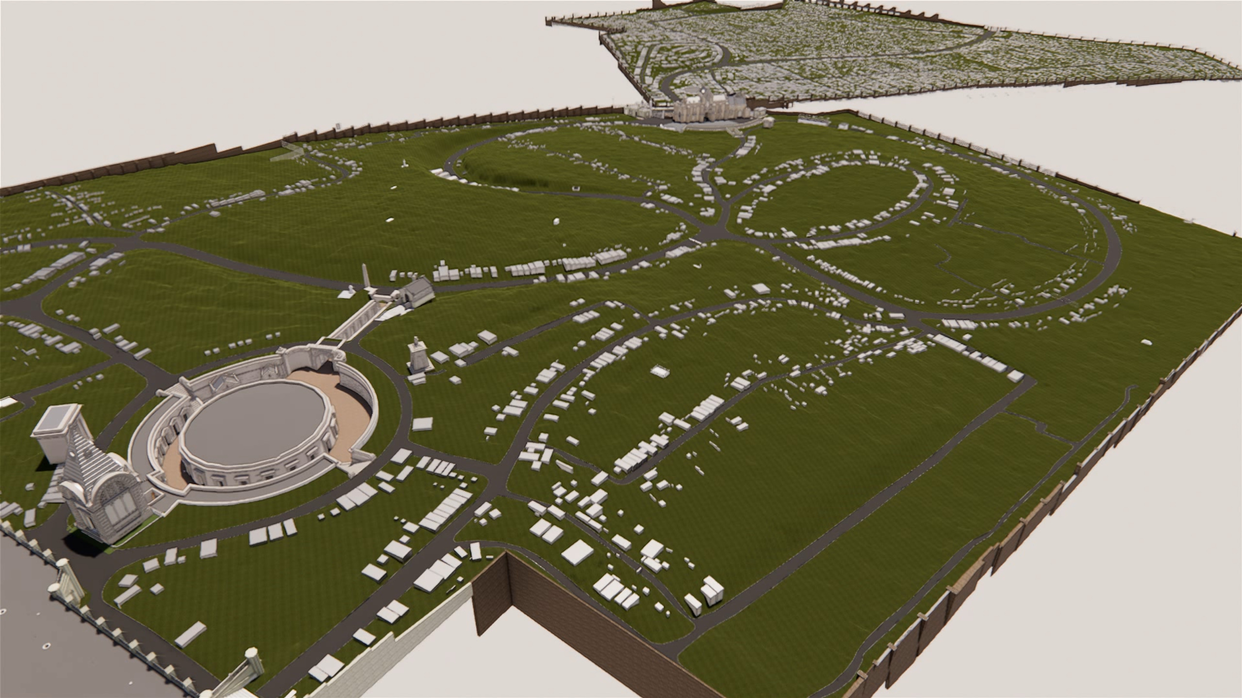
AERIAL SURVEYS

EXPERIENCE THE POWER OF PRECISION AND PACE

Speed & Precision Redefined

Certified pilots operate our high-resolution camera-equipped aircraft, enabling swift and accurate geospatial surveys in congested or expansive areas. Our teams efficiently capture precise data and imagery for hard-to reach locations, outpacing traditional survey methods.

UAV & Terrestrial Scanning: Unrivaled Site Insight

UAV and terrestrial scanning synergize for maximum coverage and survey control, capturing every detail. This comprehensive site view integrates seamlessly into project workflows, enhancing design, management, and overall efficiency.

Accuracy & Efficiency Elevated

Regardless of project complexity involving hazardous, expansive, or inaccessible sites, our cutting-edge drone technology provides a wide range of surveying and inspection services. Utilizing advanced aerial systems, we deliver fast, accurate data acquisition while minimizing risks and costs.

BENEFITS OF AERIAL SURVEYS

  • Enhanced access:
    Easily reach remote or difficult locations.

  • Rapid data:
    Quickly cover large areas, saving time and costs.

  • High-resolution:
    Capture detailed images and videos for accuracy.

  • Flexible deployment:
    Fast response for emergencies or time-sensitive projects.

  • Improved safety:
    Minimize risks by avoiding hazards.

  • Versatile use:
    Adaptable across construction, agriculture, and environmental.

HOW DOES IT WORK?

MEASUREMENT, MODELLING AND ANALYSIS

  • Delivering expertise and scale

  • Optimised technology and processes

  • Rapid programmes

  • With a personal service

FAQs

Aerial surveys involve using aircraft or drones equipped with advanced cameras and sensors to capture high-resolution images and data of a target area from above. These images are then processed using specialized software to generate detailed maps, 3D models, or other geospatial information. Aerial surveys allow for quick and efficient data collection over large or difficult-to-access areas, providing valuable insights for various industries.

The accuracy of aerial surveys depends on factors such as image resolution, camera quality, flight altitude, and ground control points (GCPs). When properly planned and executed, aerial surveys can achieve accuracies within a few centimeters. High-quality equipment and careful planning help enhance the overall precision of the resulting data.

The cost of aerial surveys varies depending on factors such as project size, location, required accuracy, and equipment used. Drone-based aerial surveys are generally more cost-effective than those conducted with manned aircraft due to lower operational costs.

Get in touch with us to discuss your needs and we will be able to give you an accurate quote.

Aerial surveys have diverse applications across various industries, including:

Construction: Monitoring progress, inspecting structures, and generating as-built models.

Agriculture: Assessing crop health, managing resources, and optimizing yields.

Environmental monitoring: Analyzing vegetation, wildlife habitats, and land use patterns.

Urban planning: Evaluating infrastructure development, transportation networks, and land use.

Disaster management: Assessing damage and aiding in recovery efforts after natural disasters.

Mining and geology: Conducting volumetric analysis, monitoring progress, and creating geological maps.

GET IN TOUCH