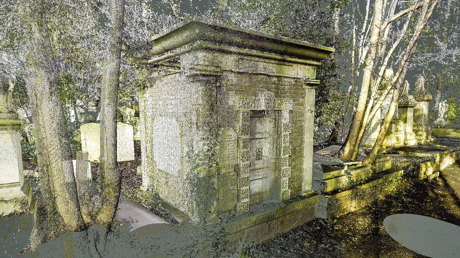
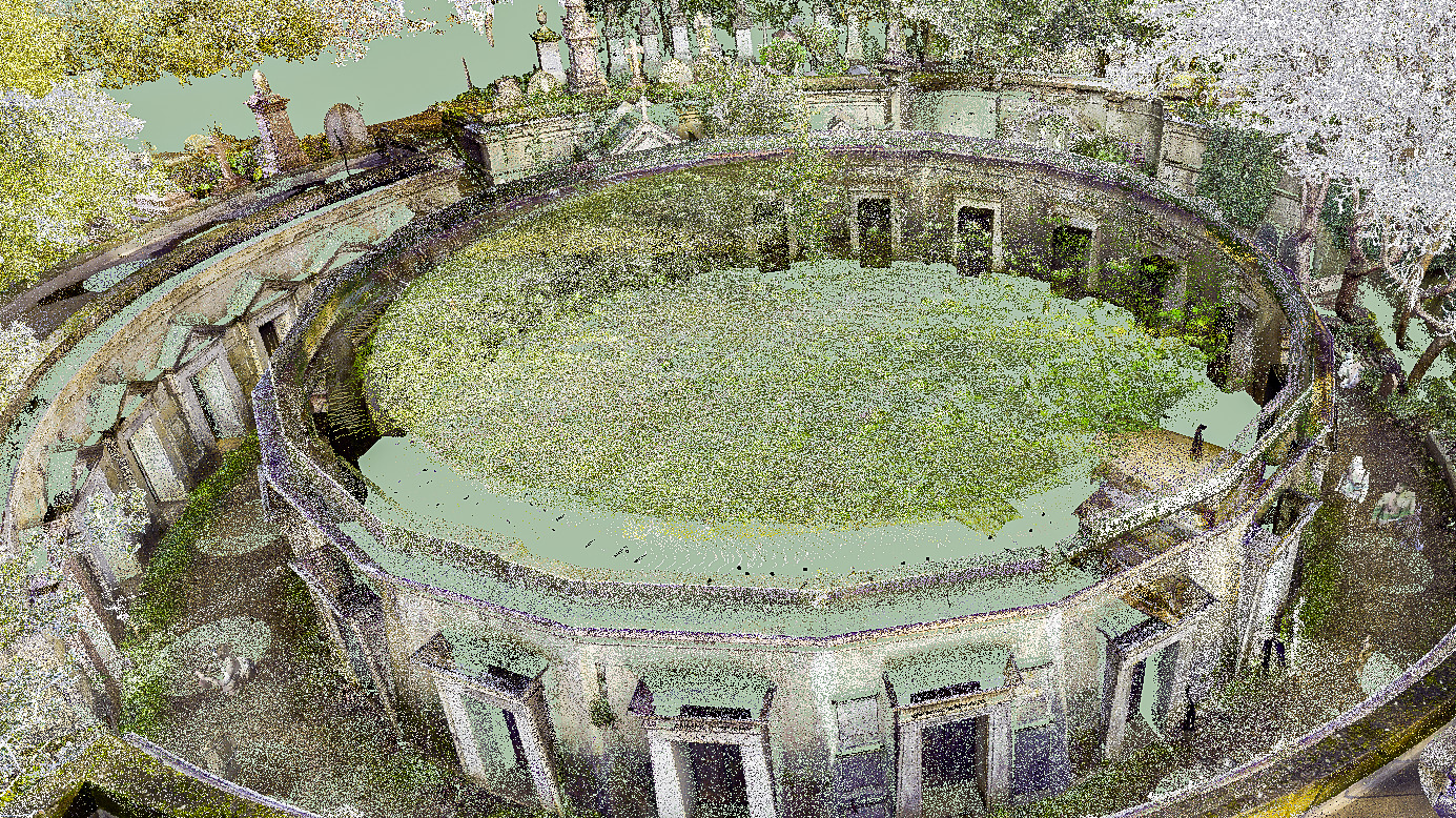
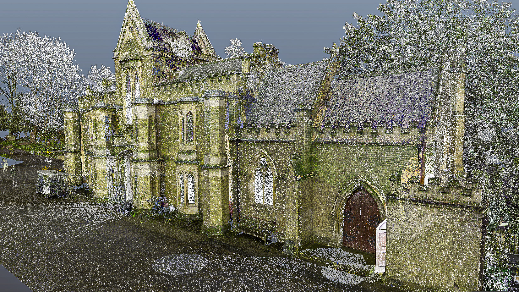
3D LASER SCANNING

UNLOCK YOUR SURVEY’S FULL POTENTIAL

Comprehensive Insights for Complex Projects

Our state-of-the-art equipment captures accurate, detailed 360° scans of complex structures and environments, delivering a comprehensive understanding of your project.

Unleash Infinite Potential with Versatile Point Clouds

The possibilities are endless with the remarkable point clouds for you to use in a multitude of ways. These scans can be converted into 2D plans, sections and elevations, 3D and BIM-ready models, topographical plans, and for virtual site visits.

Capture Every Detail in One Visit

3D laser scanning technology allows a comprehensive understanding of your project with just one visit to the site. This eliminates the need for costly revisits and minimises the risk of missing important details. Our technology empowers you to plan, design, and execute your projects with confidence, knowing that you have captured every detail.

BENEFITS OF 3D LASER SCANNING

  • Accurate drawings of internal & external floor plans, sections and elevations

  • Greater understanding of the space and design limitations

  • Understand and mitigate against design risks before ground is broken

  • Highly accurate measurements to the nearest cm
  • Quickly provide answers to questions being asked by managers and investors

  • Gathered data can be presented in both 2D and 3D views

HOW DOES IT WORK?

MEASUREMENT, MODELLING AND ANALYSIS

  • Delivering expertise and scale

  • Optimised technology and processes

  • Rapid programmes

  • With a personal service

FAQs

When you come to us with a rough plan or an idea, we will use our state-of-the-art software and equipment to scan the area. Our laser scanning technology is powerful and accurate, so it helps to complete and verify surveys and models more easily.

Laser software captures a vast amount of data in a short time, so it is a great tool to quickly provide answers to the questions being asked by managers, investors and more.

3d laser scanning is far more accurate and much quicker than traditional methods. Using the latest equipment, we can measure every part of your project to the nearest centimetre without any problems.

When we have performed this 3D laser scan, we are then able to recommend solutions for the future of your project, help to generate new plans or even project manage the whole construction.

The cost of a 3d laser scan largely depends on the requirements and size of your project as well as  the level of detail needed for it.

Get in touch with us to discuss your needs and we will be able to give you an accurate quote.

Using laser scanning we can collect data from objects, surfaces, buildings and landscapes, in the form of point cloud data, which consists of millions of 3D coordinates. Laser scanning is used by many projects for example in construction, road surveying or national defence.

Some of its other applications include:

  • Spatial scanning
  • Road surveying and traffic construction analysis
  • Urban topography

GET IN TOUCH