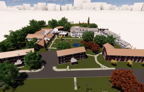
University of Leicester, Brookfield Campus
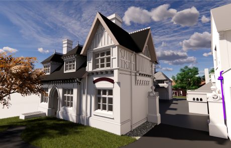
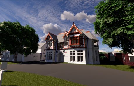
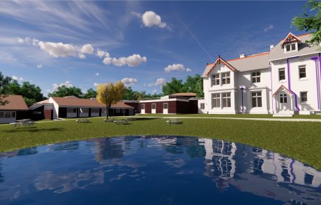
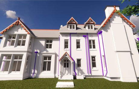
The University of Leicester’s Brookfield Campus is a 7.35 acre site comprising of mature trees, gardens and a large pond. There are several University buildings on the site, as well as six heritage buildings.
Our client wished to refurbish the buildings and incorporate these into the new build extension. Digital Inc were asked to provide a full survey of the whole site, including each of the existing structures. With the heritage buildings being in a state of disrepair, and mainly being used for storage, 3D laser scanning was used to survey these quickly and safely.
Digital Inc were commissioned by the University of Leicester and their lead consultants, BDP, to carry out a highly-detailed 3D laser scan survey of the entire site.
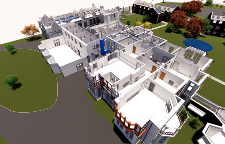
The site included six heritage buildings to be modelled in Revit to LOD400, and four modern buildings, to be modelled in Revit to LOD300. The site itself was also modelled in Revit, and a 2D topographical drawing produced.
Due to the existing project timetable, the client required a programme of nine weeks from start to finish. Because of our ‘on demand’ capabilities, we were quickly able to assemble an experienced project team which consisted of dedicated technicians and engineers to complete the survey, the modelling, and quality checking. With such a large team working on the Revit models, robust project management and QA was critical.
University of Leicester, Brookfield Campus
The University of Leicester’s Brookfield Campus is a 7.35 acre site comprising of mature trees, gardens and a large pond. There are several University buildings on the site, as well as six heritage buildings.
Our client wished to refurbish the buildings and incorporate these into the new build extension. Digital Inc were asked to provide a full survey of the whole site, including each of the existing structures. With the heritage buildings being in a state of disrepair, and mainly being used for storage, 3D laser scanning was used to survey these quickly and safely.
Digital Inc were commissioned by the University of Leicester and their lead consultants, BDP, to carry out a highly-detailed 3D laser scan survey of the entire site.
The site included six heritage buildings to be modelled in Revit to LOD400, and four modern buildings, to be modelled in Revit to LOD300. The site itself was also modelled in Revit, and a 2D topographical drawing produced.
Due to the existing project timetable, the client required a programme of nine weeks from start to finish. Because of our ‘on demand’ capabilities, we were quickly able to assemble an experienced project team which consisted of dedicated technicians and engineers to complete the survey, the modelling, and quality checking. With such a large team working on the Revit models, robust project management and QA was critical.
")
")
")
")
")
")